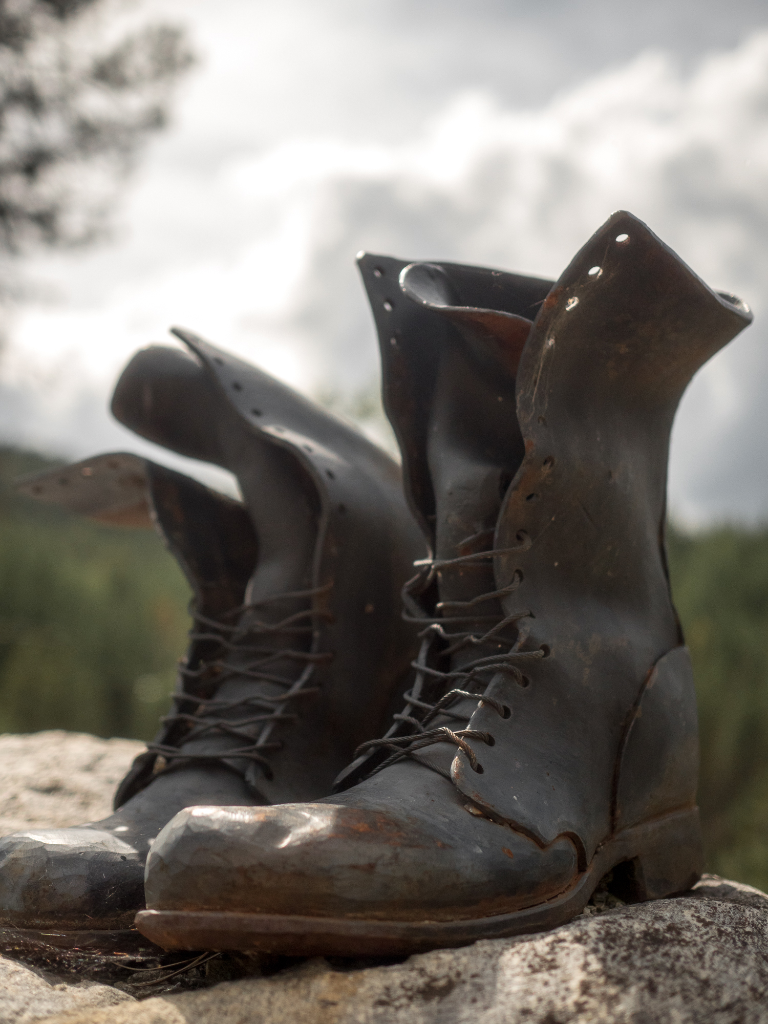
Day 11 Kettle Falls to Bacon Bike Hostel 18.5 miles
The iconic Bacon Bike Hostel sits high among the trees amidst rolling hills in Colville, WA. Shelly Bacon has dedicated her house to bikers equipped with kitchen, laundry and bedrooms. We arrived early after taking a slight detour (I dare not say we got lost) and joined a lovely Englander who was out for a 10-day ride. We also met Aldy the hostel lab, who I spent most of the afternoon and next morning playing hide and seek with.
Day 12 Bacon Bike Hostel to Lake Gillette Campground 23 miles
We had another short day to a beautiful spot beside Lake Gillette in Colville National Forest. We met a lovely guy, the only one in the campground that had just remodeled a travel trailer and was eager to show it off. He had bought the original for $100 and did quite an impressive job with homemade wood cabinets and a complete makeover of the floors and walls. He knew a lot about the history of the area, and told us about his quest for gold that apparently was buried high up around a homestead that was built in the early 1900s. The guy who buried the gold was murdered but no one has ever found it and this guy is on the hunt for it. That night for dinner I mixed together an onion, lettuce, carrots and mac n cheese (dinner of champs).
Day 13 Lake Gillette Campground to Mill Creek Stealth site 35 miles
A storm pushed us off our bikes and back into a forested area along the river. We got the tent set up and all our gear in a few moments after the down pour started, so we were only slightly soaked. The rain lasted all afternoon and Matt and I had a shivering long afternoon in the tent. We finally got to peak outside just long enough to cook ramen over our alcohol stove. We then retreated back into the tent, as the rain continued to fall.
Day 14 Stealth Site to Priest River Recreation Area 36 miles
Heavy fog and mist made it hard to get out of the dry sleeping bags. There is nothing worse then to have to pack up a soaking wet tent, in 30′ weather. We made coffee with the leftover denatured alcohol, which was enough to warm us for a few minutes. We packed quickly and got on the bikes to warm up and get some internal body heat flowing. With all of my layers on, my hands were still freezing and I tried to position them behind my handle bar bag to protect them from the chill of the wind. We had a few slight climbs and descents and after 8 miles, sought refuge at the Manressa Grotto, a huge cave carved out along the Kalispel Indian Reservation. We stayed in the damp cave for about an hour, goofing off taking pictures and pretending to sword fight with sticks (entirely my idea). Soon blue sky started peaking out and we were off to Usk to pick up snacks for the day. We stopped at the one store in town and enjoyed two coffees, two amazing breakfast burritos and one chocolate donut. We ate outside on the curb, letting the sun warm our shoes and jackets. We pushed on passed New Port and into Priest River where we couldn’t turn down sandwiches and shakes from the local diner before camping at the biker friendly Recreation Area. That night we met a group of four from New England who were all biking the Northern Tier.
Day 15 Priest River Rec Area to Sandpoint 22 miles
A nice quick ride into Sandpoint. Saturday the city was bustling with a farmer’s market and a city wide bike ride for Autism. We decided to get a hotel room and couldn’t check in until 2pm. It was only 11am, so we decided to use their hot tub to soak my knee and walk around the town. Now I know this does not quite seem like roughing it, chilling in a hot tub, but I can’t tell you how much it helped my knee. The hours ticked by and soon it was time to retreat into the room, with a pizza and a local bottle of cabernet. Some how, the rain knew just when to open up and begin to pour, right as I lay in bed, ice on my knee and Dances with Wolves on the tv.
At this point our $19.99 track phone from Walmart has refused to turn on for the second time. You’d think we would be smart enough after the first one failed after a week of use, that we would do something else, but nope, just replaced it and hoped for the best. Sadly there are no Walmarts on our route thus far, so I will continue to carry this lifeless phone until I can return it and get my money back. However, we can use our I-pods when we have wifi, but calling to make reservations at campsites a head of time is not possible, so we’ll have to wing it.
Day 16 Sandpoint to Cabinet George Rec Area 40 miles
HAPPY FATHER’S DAY! We slept in until 7am and pigged out on a continental breakfast, waffles, hardboiled eggs, egg/cheese sausage sandwhich, apple, coffee and orange juice (and yes this is only what I ate). We were able to face time with Jeff and talk with Jerry to wish them a great Day. We then loaded everything up, turned in the keys and pedaled east following a railroad track along Lake Pend Oreille. Beautiful views of the lake surrounded by the mountains we continue to climb. Being Sunday, we didn’t have much traffic from semi’s and logging trucks. We ended up finding a small beautiful stealth site, not listed in our guide book. 
Day 17 Cabinet George to Libby 54 miles
THANK YOU AMY FOR RECOMMENDING THE I-T BAND. I picked one up in Sandpoint and had some luck with it the day before, but today I had no knee pain in the afternoon. We also had to switch over to mountain time, which means we started at 8:30 am instead of 7:30. I feel somewhat defeated when we leave after 8 am. The first 15 miles were a breeze nestled deep within the woods along Highway 56. We stopped short as a pair of female Bighorn Sheep had their babies grazing along the highway. We stopped and watched them intensely as the babies would run back into the woods as cars would fly around the corners and then slowly come back out when all was clear and quiet. At around 2pm we arrived at a possible camp site, but having the knee pain minimal, after I figured out the right tightness of the wrap, I was not ready to quit for the day. We cycled passed a store we were going to eat at, so we ended up eating lunch outside a closed restaurant. Our cheese and avocado wraps tasted delightful while rocking in the rocking chairs on the front porch of the restaurant. A nice man quietly opened the door and I thought he was going to throw us off the porch, but instead he just wanted to talk. This guy didn’t own the restaurant, but he had enough authority to let us in to use the restroom. He wished us well and we continued on stopping at Kootenai Falls where we walked across a swinging bridge and delightfully rested at the falls. There was no camping at the falls, so we filled up on water and were planning to stealth camp somewhere in the National Forest. However, the road quickly became steep on both sides and I put it on auto pilot and drifted into Libby. We stayed at a campsite where I iced my knee and was in bed by 8.
Day 18 Libby to Campground 25.5 miles
Short day due to morning storms. We hung out at the local grocery store and used their wifi until noon when the rain stopped. We quickly biked out of town and rode on Old Haul Road. The stretch of road was like our own bike path along a railroad track, with rolling hills, beautiful yellow flowers and no cars. We made the short climb up to Libby Dam and then camped a few miles passed it. I soaked my knee in the river and had an impromptu swim when the sun came out at around 7pm. We are spotting more and more white tailed deer everyday.
Day 19 Campground to Eureka 35 mile
We met up with the group of four that we had met back in Washington and all camped at the city park along with another couple that was biking for a few weeks. We all set up our tents next to the Farmer’s Market that is held every Wednesday evening. It was great to see the artwork and have our tents front and center to all the locals walking around and able to listen to an accordion performance. So far we have hit four local farmer’s markets, which is a great way to see a glimpse of the town.
Day 20 Eureka to Columbia Falls 70 miles
This was our longest mileage day yet. Thank you I-T band, many podcasts and the ongoing soundtrack from my childhood of “I’ve got the joy, joy, joy down in my heart…where? Down in my heart….where?” That I continue to sing to myself as the miles drift by.
Day 21 Columbia Falls to West Glacier 17 miles
700 miles plus 🙂
![IMG_0042[1]](https://crossingacontinent.com/wp-content/uploads/2026/04/IMG_00421.jpg)
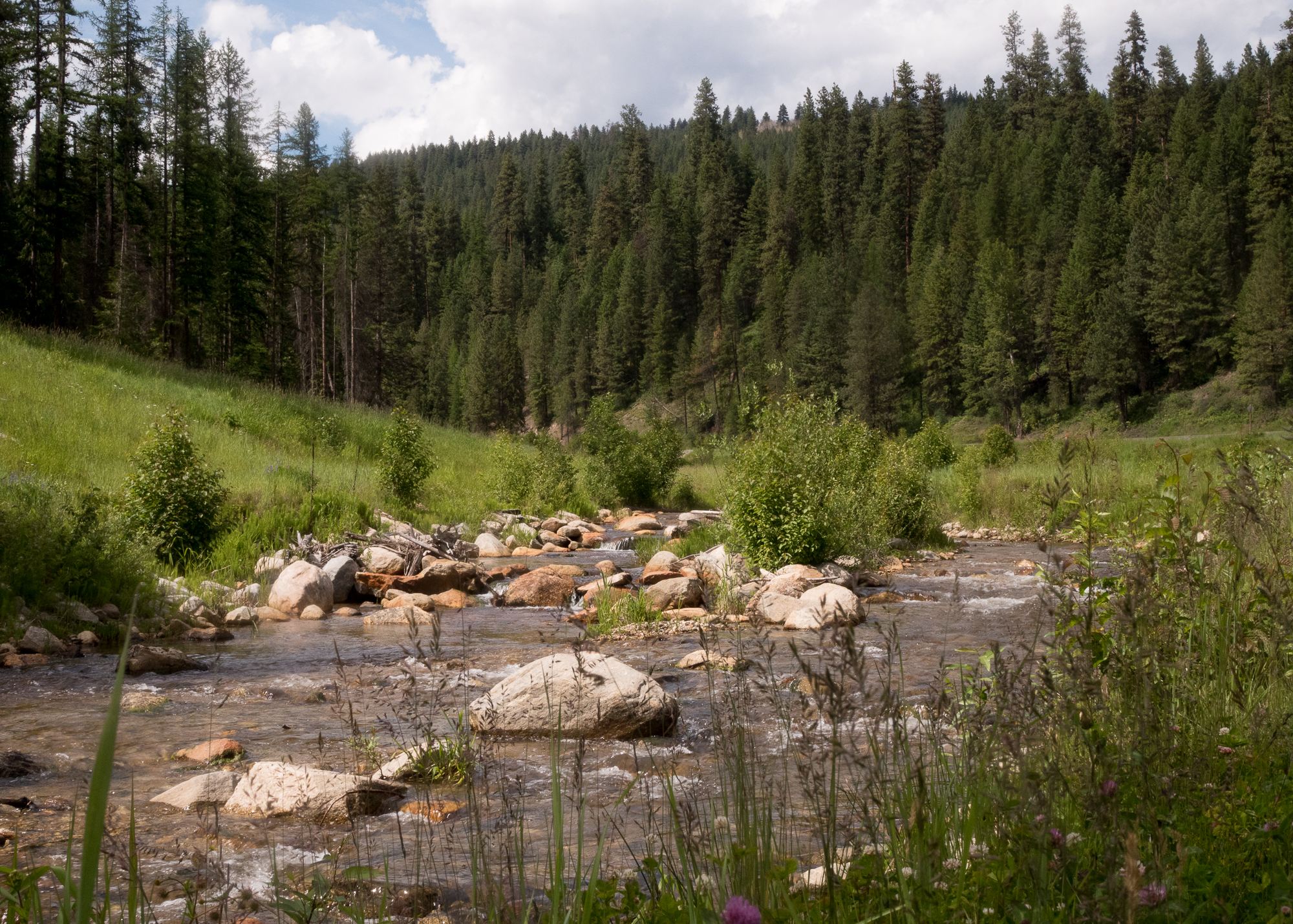
![IMG_0030[1]](https://crossingacontinent.com/wp-content/uploads/2026/04/IMG_00301.jpg) herman Pass. The last three days have been a whirling of miles, small towns and cute resting spots. In Tonasket, the vistor center offers a patch of grass behind it for bikers headed through. We spent the evening visiting their local co-op treating ourselves to a bottle of their local hard blueberry cider shared over a radio-story from This American Life. We camped right across from a yoga studio, but being Sunday it was closed. Monday started right off the bat with a tough climb up the Wauconda Pass (4310′), preparing ourselves and my knee for next day to come. We peaked and descended and were surprised when the trail told us to hang a left onto a paved bicycle path that took us high above state road 20. It weaved in and out and around the mountain side. It was a nice enclosed ride closing out our day. That evening we set up camp outside Republic at their fair grounds. Free Ranged goats came up to us and sniffed at our gear. I had just resupplied and had a kale/spinach bag that i let them nibble at. They reminded me of my days spent with the goats at the Brevard Zoo’s Petting Zone. We also reunited with Dan and Lise and their tribe who are cycling for victims of strokes. They are pulling a travel trailer and our biking each day while a support crew brings the trailer to meet them along the way and at night. They are headed East as well but will finish in Boston. They are looking for a driver to help with the trailer over the next two months, so if you or you know of someone wanting to help check out Spokesfightingstrokes.org. We went to bed early and and parted with our new friends early the next morning to fight the 15 mile climb to our highest point on the Northern Tier, Sherman Pass. My knee ached the entire way and I had taken my recommended dose of Advil for the whole day by 11am. Two hours later we reached the top, took a break and clipped in for the final 20 mile steep descent. As long as I can just glide and not have to use my knee, I can get off the mountain. The wind had started wipping up, and the temp dropped, so we put on all our layers for the downhill. Face covered with a buff, the thrilling downhill had finally brought joy and pain relief. I had finally perfected my downhill and the fear was now replaced with joyful speed. We stopped 12 miles down at a spot where the CCC had built an American Camp during the Great Depression. A small pebbled creek runs along side a small meadow of wildflowers. The only building that remains is a small bath house and historical signs describing the area. With the sun shining down on the creek we took a long break, ate a snack and I soaked my knee. The pain was immediately gone as I rested it in the water. Had it not been in the low 60’s I would have gone for a full body submersion, but the air was too cold. As the clouds moved in, we left that special spot and completed the downhill across the Columbia River and into Kettle Falls campground. The east side of Sherman Pass was by far the prettiest part of the trip thus far. It followed a creek the whole way up with lots of waterfalls and dammed ponds.
herman Pass. The last three days have been a whirling of miles, small towns and cute resting spots. In Tonasket, the vistor center offers a patch of grass behind it for bikers headed through. We spent the evening visiting their local co-op treating ourselves to a bottle of their local hard blueberry cider shared over a radio-story from This American Life. We camped right across from a yoga studio, but being Sunday it was closed. Monday started right off the bat with a tough climb up the Wauconda Pass (4310′), preparing ourselves and my knee for next day to come. We peaked and descended and were surprised when the trail told us to hang a left onto a paved bicycle path that took us high above state road 20. It weaved in and out and around the mountain side. It was a nice enclosed ride closing out our day. That evening we set up camp outside Republic at their fair grounds. Free Ranged goats came up to us and sniffed at our gear. I had just resupplied and had a kale/spinach bag that i let them nibble at. They reminded me of my days spent with the goats at the Brevard Zoo’s Petting Zone. We also reunited with Dan and Lise and their tribe who are cycling for victims of strokes. They are pulling a travel trailer and our biking each day while a support crew brings the trailer to meet them along the way and at night. They are headed East as well but will finish in Boston. They are looking for a driver to help with the trailer over the next two months, so if you or you know of someone wanting to help check out Spokesfightingstrokes.org. We went to bed early and and parted with our new friends early the next morning to fight the 15 mile climb to our highest point on the Northern Tier, Sherman Pass. My knee ached the entire way and I had taken my recommended dose of Advil for the whole day by 11am. Two hours later we reached the top, took a break and clipped in for the final 20 mile steep descent. As long as I can just glide and not have to use my knee, I can get off the mountain. The wind had started wipping up, and the temp dropped, so we put on all our layers for the downhill. Face covered with a buff, the thrilling downhill had finally brought joy and pain relief. I had finally perfected my downhill and the fear was now replaced with joyful speed. We stopped 12 miles down at a spot where the CCC had built an American Camp during the Great Depression. A small pebbled creek runs along side a small meadow of wildflowers. The only building that remains is a small bath house and historical signs describing the area. With the sun shining down on the creek we took a long break, ate a snack and I soaked my knee. The pain was immediately gone as I rested it in the water. Had it not been in the low 60’s I would have gone for a full body submersion, but the air was too cold. As the clouds moved in, we left that special spot and completed the downhill across the Columbia River and into Kettle Falls campground. The east side of Sherman Pass was by far the prettiest part of the trip thus far. It followed a creek the whole way up with lots of waterfalls and dammed ponds.